Flood Zones & Elevations
The city of Clearwater has launched an interactive map where the public can access available flood and elevation data for individual properties. The city has adopted higher standards for building elevations, and this map will show you exactly what that means for individual properties within the city’s jurisdiction.
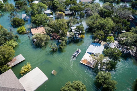
Flood Zones and Evacuation Zones are Different
Flood zones and evacuation zones are different. Flood zones are used for assessing a property’s flood risk; flooding can be caused by heavy rains, tropical storms or hurricanes. Evacuation zones are based on a property’s vulnerability to storm surge from a hurricane. Find out what your flood risk is and purchase flood insurance. Prepare ahead, know your zone, and follow evacuation orders.
Access the Flood Zone Map
Find Your Evacuation Zone
About the Interactive Flood Zone Map
- Search for a property's flood risk. Homeowners, contractors, insurance agents, realtors, and others can search for an individual property to review the property's available flood data. Search by address to find parcel-specific information regarding flood zone, Base Flood Elevation (BFE), Design Flood Elevation (DFE), important flood compliance-related warnings, and more.
- Find Elevation Certificates and other important flood-related documents for your property. Need an Elevation Certificate for a permit or for insurance purposes? If there are documents on file for your property, you'll be able to find them on the searchable Elevation Certificate page, or on the property's unique public profile.
- Review Substantial Improvement/Substantial Damage for a property. If you're hoping to make improvements to a property, you could be unknowingly nearing the property's substantial improvement threshold. Review a property's previous improvements or damages to understand possible limitations to your plans.
- Get Help. Still can't find what you're looking for? The Get Help page will allow you to contact us directly from the Forerunner map webpage with any questions you may have.